Log in
All resources
Create a design
9,296 Free Artworks of Map Collection
bibliothèque nationale de france
map of europe by nicolas and guillaume sanson (1669)
maps from gallica
guides joanne
sanson maps of south america
hendrik de leth
eran laor cartographic collection
1669 sanson map of south america
maps in the stadsarchief amsterdam
lithograph
map of europe by nicolas and guillaume sanson (1669)
bibliothèque nationale de france
map of europe by nicolas and guillaume sanson (1669)
bibliothèque nationale de france
map of europe by nicolas and guillaume sanson (1669)
bibliothèque nationale de france
map of europe by nicolas and guillaume sanson (1669)
bibliothèque nationale de france
maps from gallica
guides joanne
map of europe by nicolas and guillaume sanson (1669)
bibliothèque nationale de france
maps from gallica
guides joanne
bibliothèque nationale de france
sanson maps of asia
1669 sanson map of south america
bibliothèque nationale de france
bibliothèque nationale de france
guillaume sanson
bibliothèque nationale de france
cartouches by tomas lópez
bibliothèque nationale de france
1667 sanson map of africa
1669 sanson map of south america
bibliothèque nationale de france
bibliothèque nationale de france
sanson maps of south america
maps from gallica
guides joanne
map of europe by nicolas and guillaume sanson (1669)
bibliothèque nationale de france
map of europe by nicolas and guillaume sanson (1669)
bibliothèque nationale de france
1669 sanson map of south america
bibliothèque nationale de france
1669 sanson map of south america
bibliothèque nationale de france
map of europe by nicolas and guillaume sanson (1669)
bibliothèque nationale de france
topographia helvetiae, rhaetiae et valesiae (1654) engravings
klingnau
paris à travers les âges
lithographs of paris
glaciers and glaciation (1910)
maps of prince william sound
maps of country estates in the netherlands
het zegepralent kennemerlant
drawings in hcl (maastricht)
maastricht in the 1820s
prints by andreas juuel in the statens museum for kunst
engraving
eduard-alexis daveluy
musea brugge
situs terrae promissionis by christian van adrichom
eran laor cartographic collection
terrae sanctae tabula by guillaume delisle (1763)
eran laor cartographic collection
charts and maps of the royal museums greenwich
1584 maps
charts and maps of the royal museums greenwich
1584 maps
prints by paul sandby
esgenoôpetitj 14
cryptobranchus alleganiensis
brehms tierleben
british library - off the map alice collection - gardens
collections of the british library
eran laor cartographic collection
willem albert bachiene
bibliothèque municipale de valenciennes estampes
pierre aveline
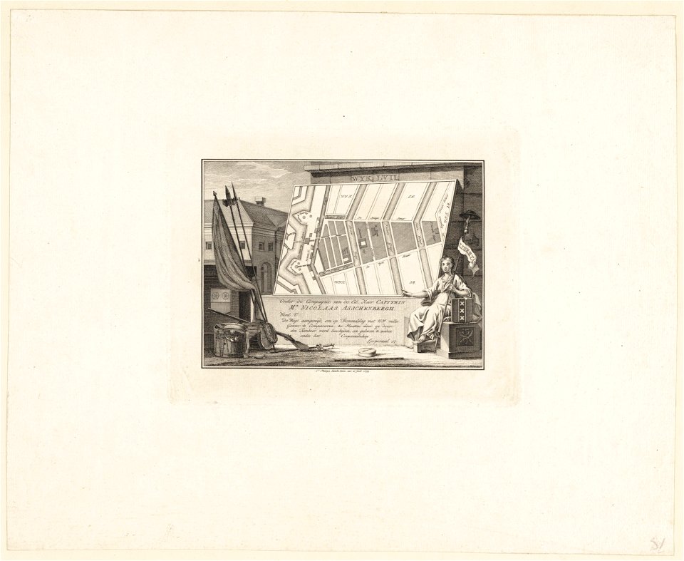
construction drawings in the stadsarchief amsterdam
daniel stoopendaal
construction drawings in the stadsarchief amsterdam
daniel stoopendaal
women of the world from the british library mechanical curator collection
the earth and its inhabitants, vol. xii: africa, vol. iii
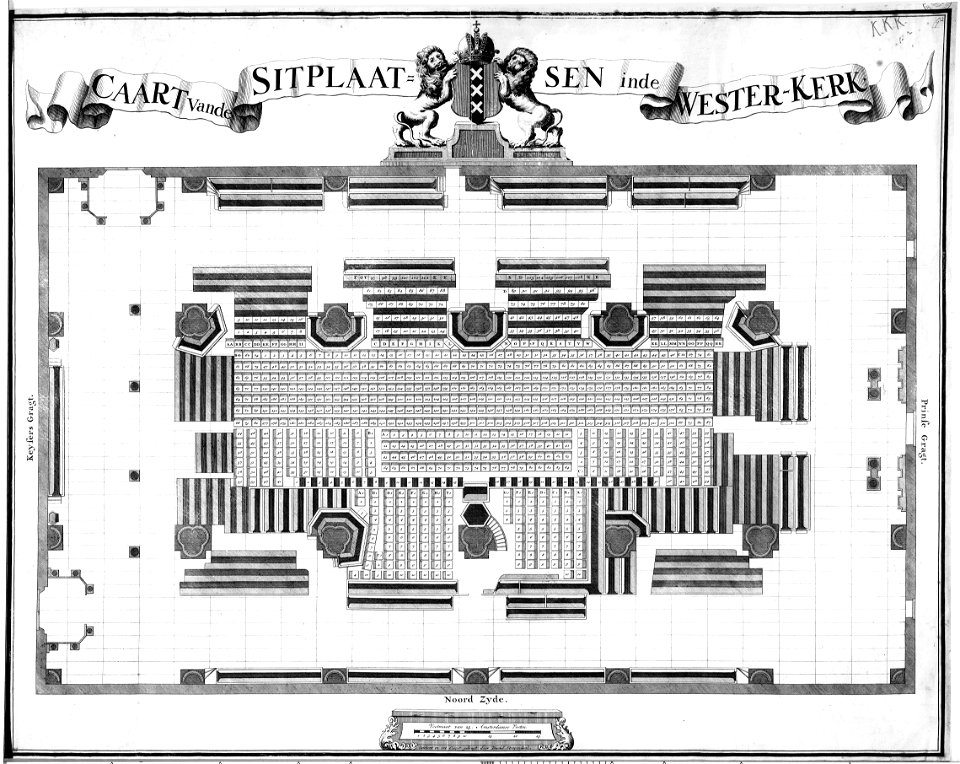
maps in the stadsarchief amsterdam
caspar philips
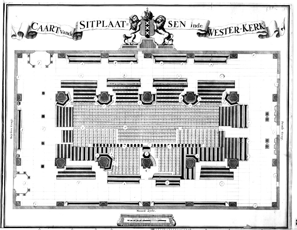
maps in the stadsarchief amsterdam
hendrik de leth
maps in the stadsarchief amsterdam
hendrik de leth
women of the world from the british library mechanical curator collection
the earth and its inhabitants, vol. v: europe, vol. v
la terra, trattato popolare di geografia universale per g. marinelli ed altri scienziati italiani, etc.
women of the world from the british library mechanical curator collection
art collection of the delft university of technology
maps of gouda by braun & hogenberg
print room of the university of antwerp
maps of antwerp by braun & hogenberg
école de nancy,art nouveau
lucien weissenburger
ministry of information second world war colour transparency collection
baroque
political cartoons by james gillray
seymour dorothy fleming
elizabeth i of england (the ditchley portrait)
open ruffs
maps in the stadsarchief amsterdam
hendrik de leth
old maps of kennemerland
hendrik de leth
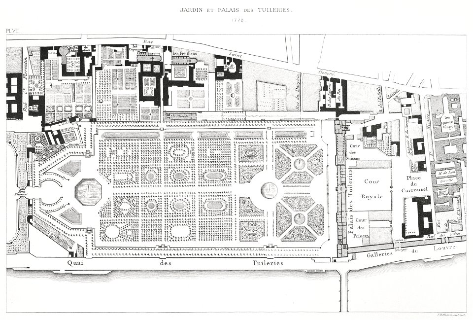
maps of the jardin des tuileries
lithographs of paris
paintings by gustave courbet in france
realism
british library asia, pacific and africa collections
twenty-four views by henry salt (1809)
atlas schoemaker-noord-brabant
old maps of eindhoven
old maps of kraków
pierre aveline
atlas sive cosmographicae (gerardus mercator, 1607)
maps of east flanders by pieter van der keere
maps of mexico by mercator-hondius
bibliothèque nationale de france
pieter verbiest (ii)
maps from gallica
maps of aden by braun & hogenberg
bibliothèque nationale de france
maps of cairo by braun & hogenberg
bibliothèque nationale de france
maps of abyssinia by mercator-hondius
bibliothèque nationale de france
johann andreas graff
wiuwert
maps from gallica
guides joanne
maps of abyssinia by mercator-hondius
bibliothèque nationale de france
maps of bar-le-duc by braun & hogenberg
bibliothèque nationale de france
bibliothèque nationale de france
maps of wales by humphrey llwyd
maps of frankfurt (main) by braun & hogenberg
bibliothèque nationale de france
maps of chios by braun & hogenberg
bibliothèque nationale de france
17th-century maps of africa
carolus allard
maps of bologna by braun & hogenberg
bibliothèque nationale de france
eran laor cartographic collection
maps of ceylon by petrus plancius
steinfels collection
engravings of bern
17th-century paintings in the amsterdam museum
paintings by pieter isaacsz
a voyage to abyssinia, and travels into the interior of that country, executed under the orders of the british government in the years 1809 & 1810
john outhett
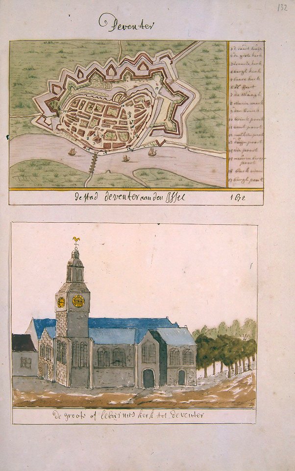
atlas schoemaker-overijssel
history of deventer
romanticism
john martin
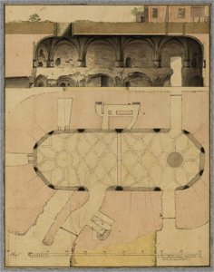
collection technical drawings from het utrechts archief
fortifications in the netherlands
brazilian paintings in the museu antônio parreiras
paintings by benedito calixto
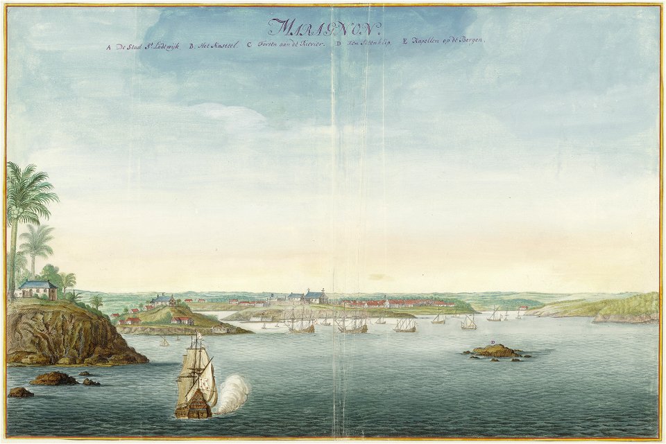
watercolor drawings by johannes vingboons
dutch brazil
maps, prints and photographs in royal danish library
carl wilhelm wiehe
maps from gallica
guides joanne
bibliothèque nationale de france
sanson maps of south america
bibliothèque nationale de france
sanson maps of south america
bibliothèque nationale de france
sanson maps of south america
bibliothèque nationale de france
sanson maps of south america
maps from gallica
guides joanne
old maps of duchy of cleves
guillaume sanson
bibliothèque nationale de france
sanson maps of south america
maps from gallica
guides joanne
maps of lizarrate by braun & hogenberg
bibliothèque nationale de france
map of the circle of lower saxony by sanson
bibliothèque nationale de france
map of the circle of bavaria by sanson
bibliothèque nationale de france
mapa del principado de cataluña (1776)
bibliothèque nationale de france
maps of lizarrate by braun & hogenberg
bibliothèque nationale de france
bibliothèque nationale de france
cartouches by tomas lópez
eran laor cartographic collection
willem albert bachiene
historical images of tents
covered wagons
maps from the mechanical curator collection
old maps of haarlem
6401 - 6500 of 9,296
Next page
/ 93